Disclaimer: A good bit of the route we hiked today is not normally open to the public. However for River Days the San Diego River Foundation and the County Parks department graciously allowed a group of us to visit the source of the river. Acknowledgments: Special thanks to Doug and Daryl for leading us on this lovely journey and all who joined us, as well as the San Diego River Park Foundation and all who have worked to make this is reality.
 |
| The group assembles |
 |
| One more glance across the river from Inaja Park. |
This has been a rather wild week in San Diego County. Some unseasonably hot and dry Santa Ana winds have been blowing in all sorts of havoc and a number of fires have been burning throughout the county. While this certainly happens from time to time in September, October and November at the end of the dry season, the fact that it's happening at the beginning of the dry season gives us much reason to worry. It is said all around the world we are beginning to see unusual weather patterns disrupt life as we know it as the planet warms in response to carbon dioxide levels not seen since the Pliocene. What are we getting into?
Today the temperature has cooled down just a bit and the onshore flow has returned. The firefighters have done an absolutely outstanding job by any measure from anticipating their need here in San Diego County to coordinating across various agencies and most importantly of all the boots on the ground. Were the fires not under control presently, we'd probably not be out here today. So we owe them a thank you as well.
 |
| Doug gives us briefing on what to expect. |
 |
| Leaving Inaja. |
The actual "trailhead" (a pullout at which we had special permission to park 5 cars) was about a mile up the road. There were more than 5 cars at Inaja so we all had to do a little carpooling and shuttling. My car is a bit on the small side so we chose to ride. This also afforded me a chance to look at the river instead of the road. As you might imagine, the bed is dry. I was also impressed with how the scale of it as it meanders has decreased. It might be mistaken for many of the other intermittent streams found around these parts.
 |
| Looking at the river from Highway 78. |
 |
| Another shot. |
 |
| Anita getting ready. |
 |
| The Older Julian highway. |
Once we were all massed up, our hike began. We followed a vestigial trace of the old highway 78. You find these sorts of "old roads" all over California. Many like this one are gated off and no longer used. A few however can be still be driven. It is said that highways such as these once traversed many of our mountain ranges back when motors were a little less muscular and earth moving a bit more expensive. They twist and turn slowing up the old mountain sides, sometimes criss crossing the modern roads, sometimes getting relegated to driveways and orphaned slabs. The old Ridge Route connecting Los Angeles with the San Joaquin Valley twisted and turned all over the mountain. Modern I-5 through Tejon Pass is much faster.
 |
| Looking upriver from the last pavement to cross it. |
 |
| Looking downstream from where the old highway crosses the river. |
Despite the drought some flowers are still blooming up here. What it must take to get enough water out of the soil to get blooms. It's truly impressive. The pace of this hike is relaxed and I find myself conversing with many on it. It is a bit different from previous hikes in that respect, but welcome. It is all different now. We are in the mountains and what we see could just as easily be something from the Sierra foothills or the Diablo ranges much further north. This is quintessential California here, with the oaks, grasses, wildflowers and rolling hills.
 |
| Wildrose. |
 |
| Poppy? |
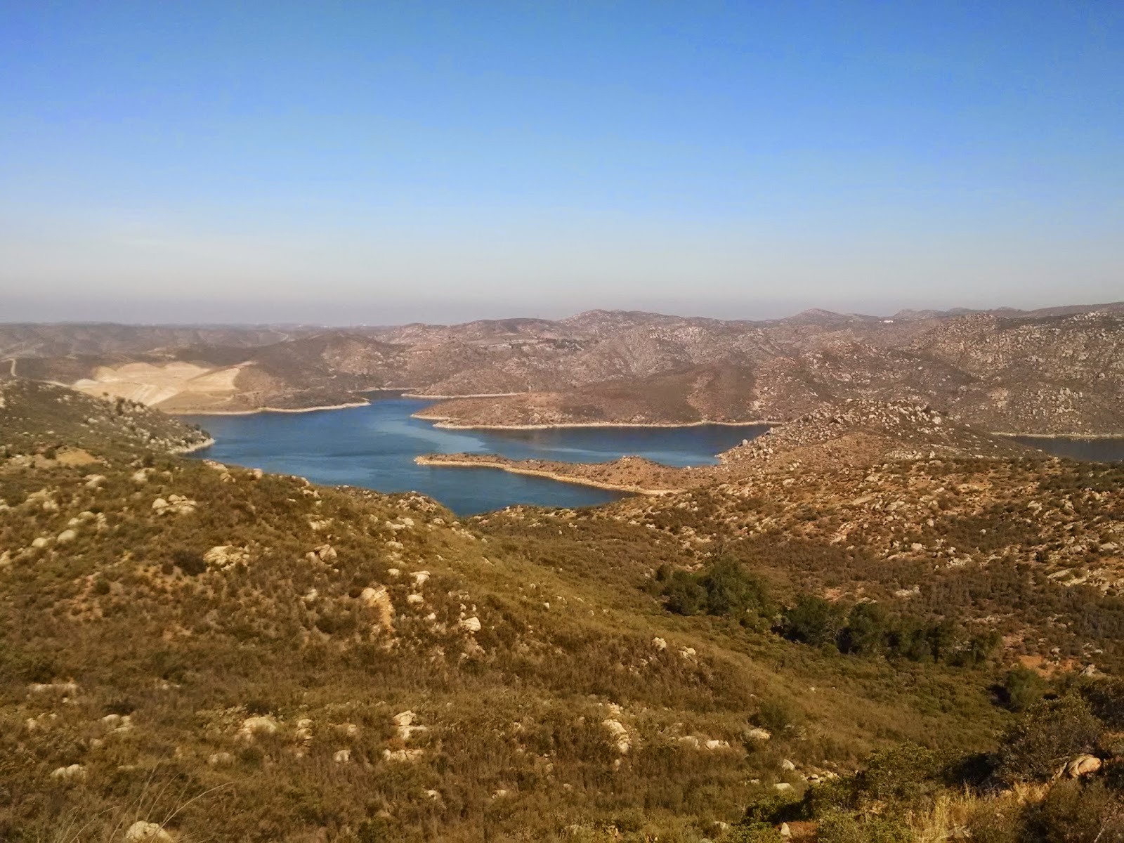
The river now seems very small and getting smaller, especially in comparison to all around it. It's getting harder to discern the main channel from the myriad of dry tributaries coming. We were now in an open bowl and the sides were nearly equidistant.
 |
| From above. |
 |
| Lovely Oak on golden hills. |
 |
| The trail ascends gently. |
 |
| Oak and sunshine. |
We join the official trail system of Santa Ysabel Open Space preserve. I learn that 20 years ago this park was in private hands, and that it was only through the hard work of the Nature Conservancy that it was acquired. I recall similar stories about the Santa Rosa Plateau outside Temecula and the developments that threatened it. Great things can be done but it takes effort in the face of growing population pressures. Wheres once upon a time everyone may have had a relative with a ranch (or so the mythology goes) now we really do need parks and so does the wildlife.
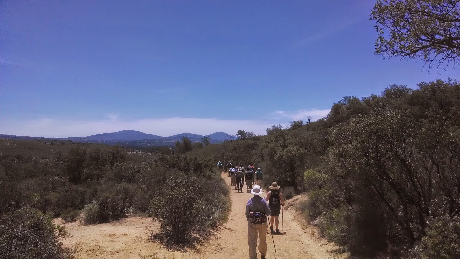
 |
| Our group heading up. |
 |
| More wildflowers. |
I find myself all over the place with respect to the group, everywhere except for the front that is. In heat I am not a fast hiker. I stop and stare too much, take too many pictures, chat with too many people . . .
Compared to last week it hardly feels like I'm doing anything, but this is a very momentous day. I think I am having a bit of trouble believing it's all real, this journey. It's been weeks of meandering, revisiting and photographing.
 |
| Now our pilgrimage to the source is nearly complete. |
 |
| Doug explains where water would be were our wet season wetter. |
We leave the trail and cross the river, now barely a rill in the landscape one more time. Before us is an ancient looking land of boulders, grasses and brush. As Doug explains, we are now in a giant bowl collecting water and focusing it on one location, the source.
 |
| 3-D of the source. |
 |
| Here we are. |
The source itself is dry today, just a collection of rocks, wildflowers and other plants tapping deeper moisture. Still we feel its coolness and energies. It is here that the journey of water begins, following our journey in reverse. We get our pictures taken and ponder it all. We are among other conservation minded folks, many of whose work has made this part of our journey a reality. We see the many expressions of natural admiration. I would suggest there is a sort of symbolism to all gathered here now. We started this journey as just the two of us and are now completing it surrounded and supported by folks who see a similar vision.
 |
| Anita at the spring. |
When I was 16 I had a dream of driving out to Point Conception. In this dream (which occurred many times in the following years) I never quite seemed to make it. As I grew older I tried to get there for real, but found my efforts thwarted by private property and tides. In my dreams I eventually did make it, and then in later ones I showed others the way. In real life it was November of 2010 when I found myself clinging for life to some shales just north of the lighthouse and decided. I was close enough. We see our visions and follow them and then find others who see it too and lead them. I would say Doug is "leading us to Point Conception" toady. It is good to know we can all play many roles in a play of greater awareness.
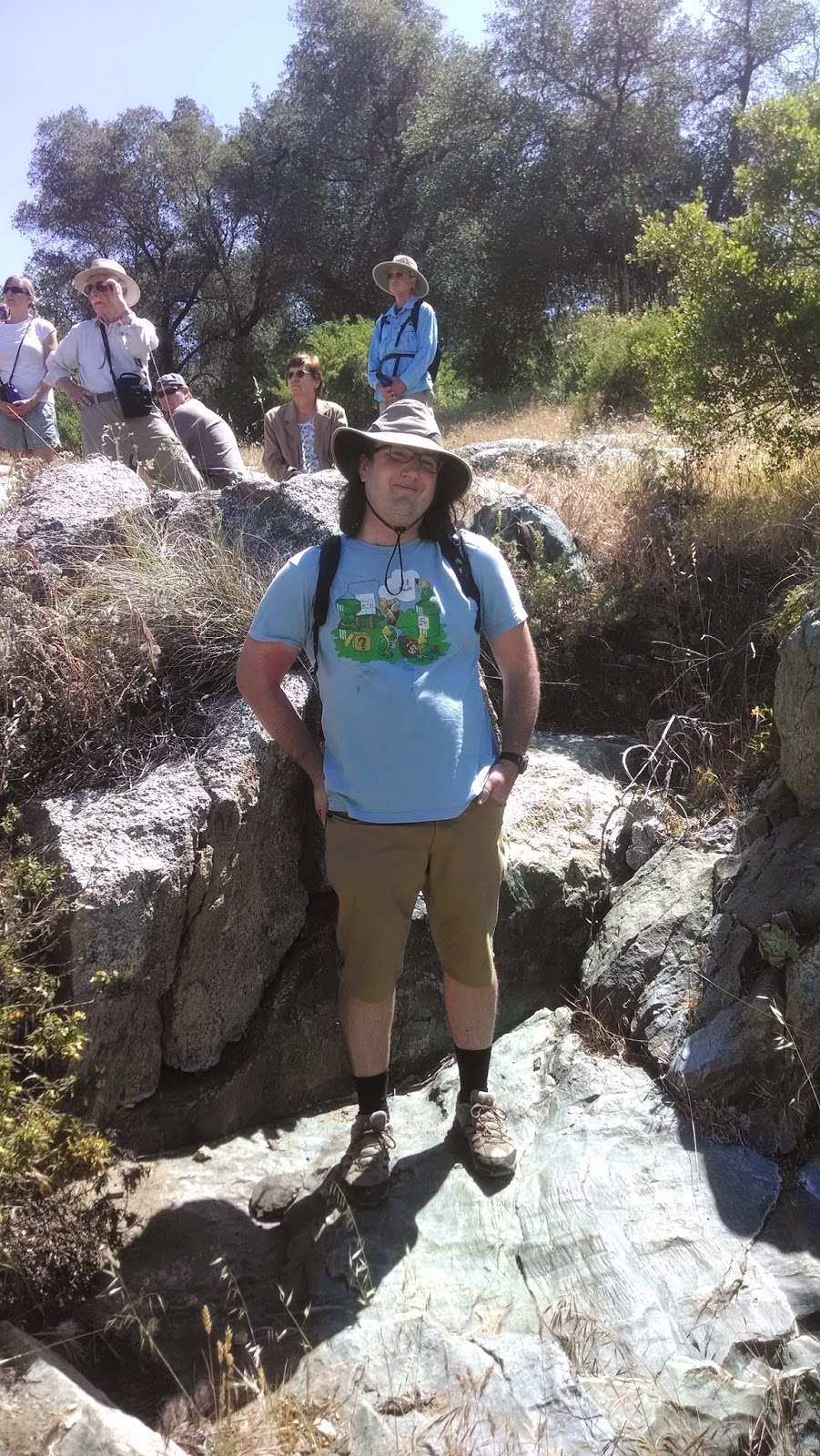 |
| Here I am. |
 |
| The water worn rocks the begin the San Diego River. |
As we walk back to the trail junction I learn more of the decades of work, much of it done by those among us to preserve open space and wildlife habitat in California and elsewhere, board meetings with the Nature Conservancy, deals for land acquisitions, easements, the development of trails, the setting aside of places where no trail will go. I recall learning from
coast walk that some of the best preserved habitat was on military bases, where it was easier to keep people away from the nests of shy birds and feet away from delicate grasses.
 |
| Me again. |
 |
| Grinding holes used by Kumeyaay |
 |
| And the road goes on. |
At the trail junction, some of us return to the cars, while others continue on to the divide. To both the North and West it is the San Dieguito River drainage. While we have crossed the west divide now several times, I still wanted to get to the north divide to look at the land beyond the head of the river. To finally cap this journey off.
 |
| Love this oak skeleton. |
 |
| Closer up. |
 |
| Looking back down valley. |
As we ascend we are treated to more and more dramatic views of the upper San Diego River catchment and the mountains rimming it. Cuyamaca is the highest, and looks blue in the sky, but there are others as well. The temperature has risen, although not as bad as somedays, the combination of uphill and direct sun is taking its toll on us and we are relieved when things finally level out.
 |
| Cuyamaca in the distance. |
 |
| The rolling countryside. |
The trail we're on is known as the
Coast to Crest Trail, and in theory follows the San Dieguito River valley all the way to the ocean in Del Mar (Like the river park, it is still a work in progress). I've hiked and driven along some sections of it. I hope some day the San Diego River Trail and it can be one. As mentioned before, we are not the only ones out here on such a journey. There have also been several who have hiked coast to crest and you can read about their efforts
here.
 |
| Looking east. |
 |
| Looking back. |
We decide to climb as far as the top of the road and then turn around and have lunch and a well deserved beer at the picnic table. With further climbing we are treated to wildflowers, hawks, and lizards everywhere. I could love hiking here and exploring the park more fully. It is remarkably uncrowded here and the views are nothing short of breathtaking. Despite the drought there are still many wildflowers as if this spot captures enough moisture to maintain some lushness, as if an island. It is said that these "Island ecosystems" are the most at risk in an ever warming climate. Refugia that have survived 2 million years of ice ages and natural warming done in when things get outside what has been normal.
 |
| Yellowflowers |
 |
| Close up |
 |
| Rocky hillside |
 |
| Glowing cactus |
By the time we reach the Apex of our journey we are huffing, but glad to be there. Ahead the land drops off steeply into the next valley and it seems this is the divide we seek. We have now traversed ~ 52 miles of river by various means, foot, bus, train, bike, boat, hitchhiking . . . and we are atop the world. This is the second time we've made a journey. While most continue on for the full loop, Anita and I along with one other head back and take in the scenery of all we have wandered.
 |
| And here we are at the summit of the trail. |
 |
| Looking into the valley beyond |
We go slower now, more present with our surroundings, less constrained by any goal. Back at the picnic tables we find others who found journey in observing their surroundings right there. She tells us of other trails and other places and shows us the most incredible hummingbird photos I've ever seen in my life, and then describes a 3/4 mile hike that lasted 3 hours. With everyone around me I can see the world through different eyes and experience many facets and know the world is bigger than just what I see.
 |
| The journey continues |
 |
| Wild rose |
The journey back is much quicker as it often is. While we began as strangers, we leave as friends --as people who would be happy to see one another again. There is so much more to take in. I want to learn and speak and act and make. Awareness is making this happen.
 |
| Get your 3-d glasses. |
 |
| Love this knothole. |
 |
| A lone flower |
So we've "finished" but does that make it the end? Hardly so. We've revisited many places and met new friends and come away with a deeper sense of the great river system that gave birth to the city and state as we know it today. We are citizens and as so it is hoped that we will bring more to make this land a good place to human among the nature around us.
That said there are element of day to day life we have neglected that it seems time we get caught up on again. Anita is learning to drive standard. The house is overdue for some spring cleaning. There are old friends we have not seen enough of. All of these can be adventures in their own right. Although not all adventures are bloggable, some will be.
Has the journey changed us?
For sure. We see one another s bit mires strongly and a bit better supported by one another. We have seen a large swath of San Diego culture and natural history, still living and still evolving, a history snd future i will feel now foever a small part of. Finally, I have found a bit more of a voice with my writing, a pursuit I had long neglected. Given the I uncertainties if our economy one can never have too many skills.
Thank you all who have followed us and all who have aided our journey. May you, too find your destination way.